


Hurricane Center ups chances for tropical depression. Where it's going
Hurricane Center ups chances for tropical depression. Where it's going

Cheryl McCloud, USA TODAY NETWORK - FloridaTue, September 15, 2026 at 10:43 AM UTC
1
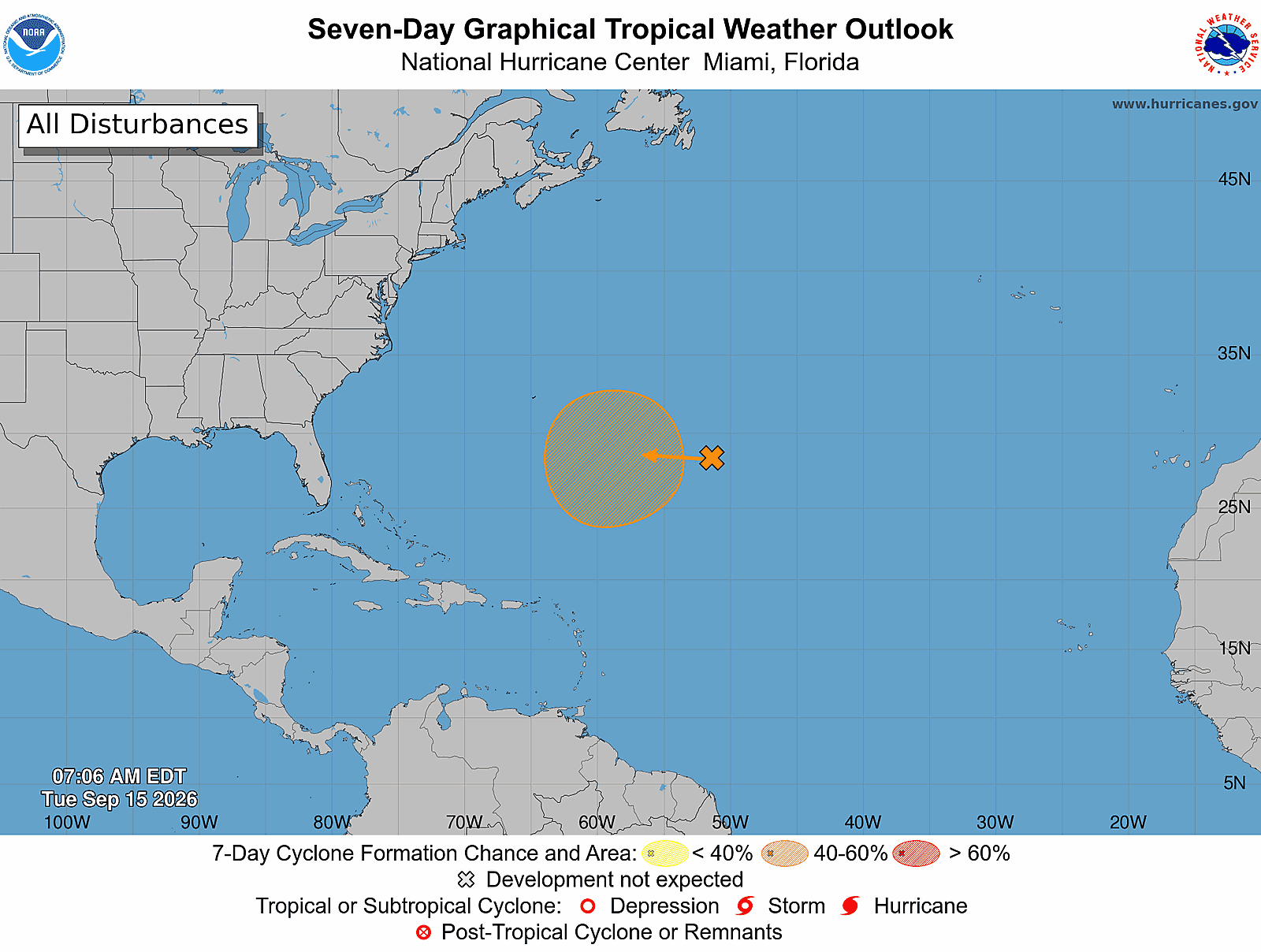
The National Hurricane Center said a tropical depression could form southeast of Bermuda later this week.
The system has a medium chance for development over the next seven days.
➤ Track all active storms
The announcement came less than a week after the Atlantic hurricane season hit its peak on Sept. 10 with five tropical storms so far in the season, well below the season average of nine storms and four hurricanes by mid-September.
Despite the effects El Niño has had on the 2026 hurricane season, weather experts urge all Florida residents to not take chances and to remain prepared.
Shop Amazon for hurricane supplies
If there are no hurricanes this year before Sept. 22, the 2026 season will break a record, the second this month.
If no hurricanes develop in the Atlantic basin this year it will be only the third time in history.
➤ Weather alerts via text: Sign up to get updates about current storms and weather events by location
If a storm does develop, the next name on the hurricane list will be Fay. Maximum sustained winds would have to reach 39 mph for the system to reach tropical storm status.
Here's the latest advisory from the National Hurricane Center as of 8 a.m., Sept. 15:
Is there a hurricane coming to Florida?
No, but a trough of low pressure southeast of Bermuda is forecast to enter an area favorable for development in a few days and could become a tropical depression.
Could we see a tropical storm or hurricane near Florida in September?
Chances are increasing for tropical development in the central Atlantic, according to the National Hurricane Center.
The National Hurricane Center continued Sept. 15 to highlight an area east-southeast of Bermuda, giving it a medium chance for development over the next seven days as it moves into an area more conducive for development.
The area could become a tropical depression later this week, the National Hurricane Center said.
AccuWeather gave the window for development of the system between Sept. 17 and Sept. 21 as it moves into a humid area with less wind shear.
The system "could bring downpours, squalls and rough seas to Bermuda, especially if it becomes a tropical storm. Currently, it does not pose a risk of direct impacts to the United States," according to AccuWeather.
Closer to Florida, AccuWeather is keeping an eye on conditions in the northern Gulf for a potential "homegrown" tropical threat.
"A dip in the jet stream along the Atlantic coast may allow a storm in the upper atmosphere to break away and drift southwestward across Florida later this week," said AccuWeather hurricane expert Alex DaSilva.
"Wind shear and the storm’s swift movement will initially prevent it from extending to the surface and developing into a tropical system," DaSilva said.
"However, if it slows down over the northern Gulf, a tropical depression or storm could develop near the Gulf Coast from late this week into this weekend."
Storms that form along or just off the coast give residents little time to prepare.
Tropical storms Arthur, Bertha and Edouard earlier this season formed within a few hundred miles of the U.S. coast.
Could we break another hurricane record this month?
If no hurricane forms by Sept. 22, the 2026 season will officially break a record for the latest date a first hurricane has ever formed, according to AccuWeather.
The latest arrival of the first hurricane in the Atlantic basin was Sept. 21, 1941.
On Sept. 12, we set a record for the latest date without the season's first hurricane
Will 2026 be a year of no hurricanes?
If this year's Atlantic season has no hurricanes by Nov. 30, it will be only the third time it's happened and that was more than 100 years ago, in 1907 and 1914.
It is possible there were hurricanes, but records before the satellite era depended on observations on those nearby.
In 1907, no Atlantic tropical storms or hurricanes were documented.
In 1914, one tropical storm was documented during the entire Atlantic season. The storm made landfall in Florida before moving into Georgia with relatively minor impacts, according to AccuWeather.
CSU predicting below-normal tropical activity through Sept. 15
In its two-week tropical forecast issued Sept. 2, Colorado State University said it was "strongly favoring below-normal activity during the next two weeks" (through Sept. 15), noting "there is very little signal for any potential TC (tropical cyclone) development in the next two weeks from any model."
Advertisement
"Global model signals for TC development in the next two weeks are remarkably weak, given the next two weeks include the climatological peak of the season."
Historically, major hurricanes develop in the eastern and central tropical Atlantic in early to mid-September, according to CSU.
The next two-week forecast from CSU will be released Sept. 16.
Tropical depression could form in central Atlantic later this week
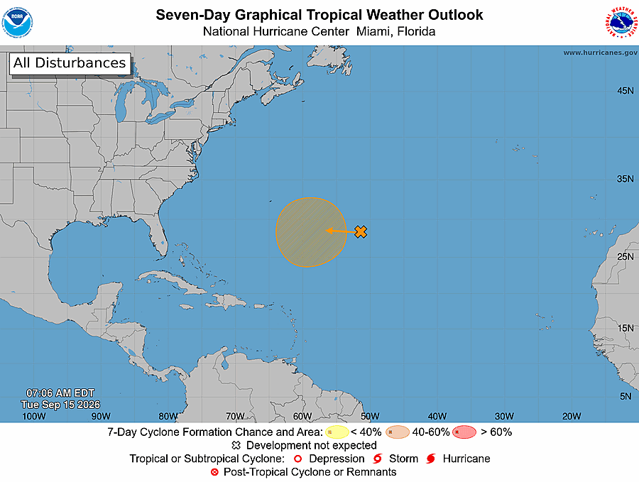
There was one disturbance listed by the National Hurricane Center on its tropical outlook map as of 8 a.m. Sept. 15.
Central Subtropical Atlantic: A trough of low pressure located well east-southeast of Bermuda continues to produce disorganized showers and thunderstorms.
Environmental conditions are forecast to become more conducive for development in a few days, and a tropical depression could form late this week as the system moves slowly westward to west-northwestward over the subtropical Atlantic.
Formation chance through 48 hours: low, near 0 percent
Formation chance through 7 days: medium, 40 percent
There is one tropical wave:
A sharp tropical wave is along 55W, south of 21N, moving westward at 11 to 17 mph.
What do the colored, hatched areas on the NHC map mean?
The hatched areas on the National Hurricane Center's tropical outlook map indicate "areas where a tropical cyclone — which could be a tropical depression, tropical storm or hurricane — could develop," said National Hurricane Center Deputy Director Jamie Rhome.
➤ Hurricane Center is testing new cone: What's changing the season
The colors make it visibly clear how likely a system could develop, with orange medium and red high. In 2026, the tropical outlook will use a gray X to indicate disturbances with a low chance for development.
The National Hurricane Center generally doesn't issue tropical advisories until there is a named storm, but there is an exception.
"If a system is near land and there is potential for development, the National Hurricane Center won't wait before it issues advisories, even if the system hasn't become an actual storm. This gives residents time to prepare," Rhome said.
What is a disturbance?
The National Hurricane Center's tropical outlook map highlights "disturbances" in the Atlantic basin.
These are clusters of storms with some organization, but which don't have a defined circulation typical of tropical cyclones.
➤ Ready or not, National Hurricane Center resumes daily tropical outlooks
If shown on the tropical outlook map in orange or red, forecasters are predicting the potential of those disturbances into developing as medium or high, respectively.
Disturbances shown on the map with a gray x have little to no chance for development. This is a change from prior years which indicated such disturbances in yellow.
What is a tropical wave?
"Tropical waves are clusters of showers and thunderstorms that act as the seedlings for many tropical storms throughout the Atlantic season," said Alex DaSilva, AccuWeather lead hurricane expert, via email.
“There are about 60 tropical waves that move across the Atlantic each year, and roughly 10 percent to 15 percent of them develop into a tropical system. That’s about one in seven.
"Tropical waves are important because they contribute to about 80 percent of all major hurricanes."
When is hurricane season?
The Atlantic hurricane season runs from June 1 through Nov. 30.
Ninety-seven percent of tropical cyclone activity occurs during this time period, NOAA said.
➤ Hurricane Center testing new cone: What's changing this season?
The Atlantic basin includes the northern Atlantic Ocean, Caribbean Sea and Gulf of America, as the Gulf of Mexico is now known in the U.S. per an order from President Trump. NOAA and the National Hurricane Center are now using Gulf of America on its maps and in its advisories.
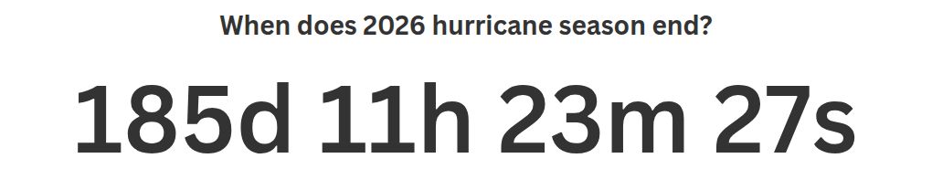
Countdown clock to end of 2026 Atlantic hurricane season
How many tropical storms, hurricanes are in a typical season?
The 30-year average, from 1991 to 2020, is for 14 named storms, seven hurricanes and three major hurricanes.
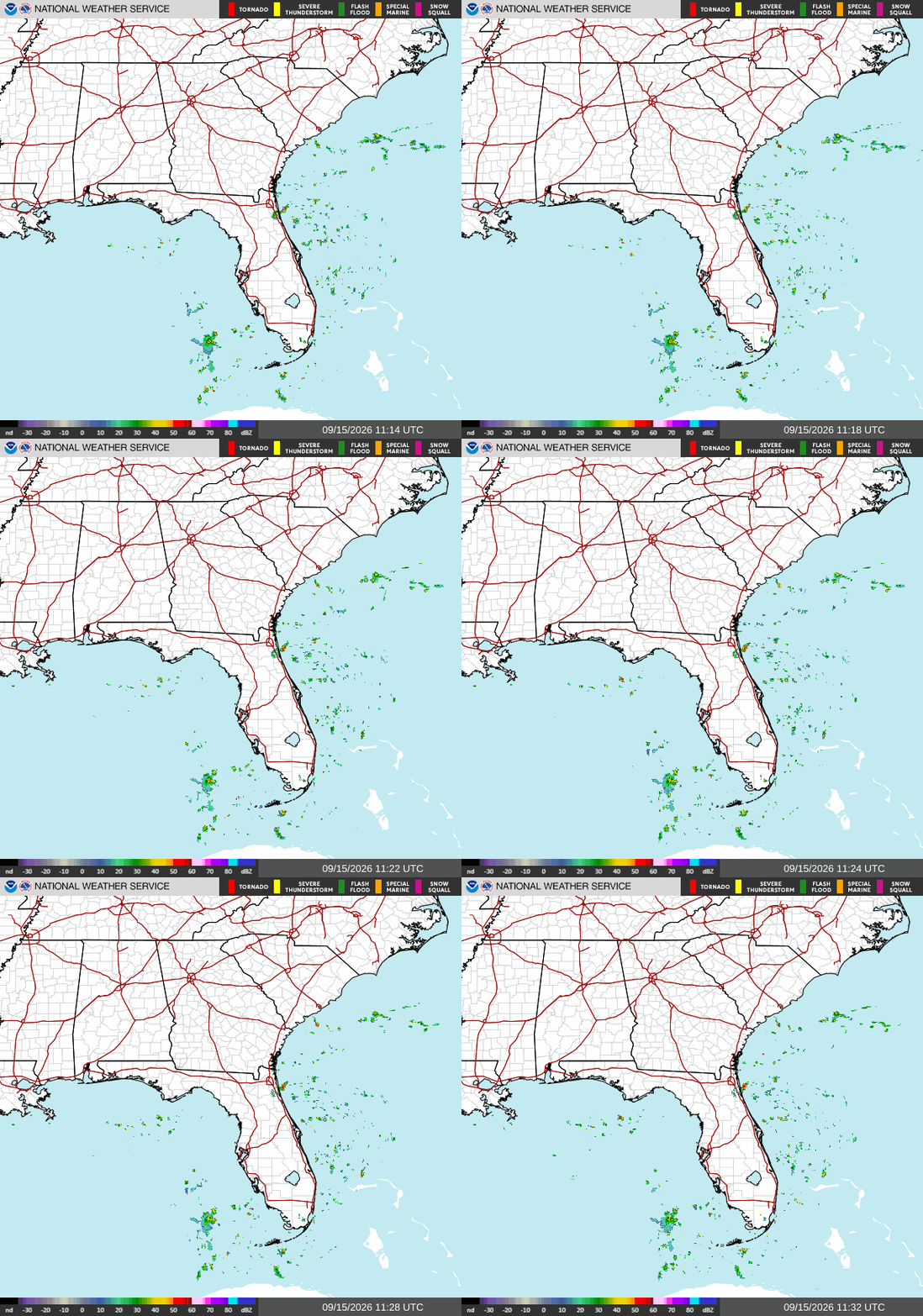
Florida weather radar for Sept. 15, 2026
Weather watches and warnings issued in FloridaWhen is the peak of hurricane season?
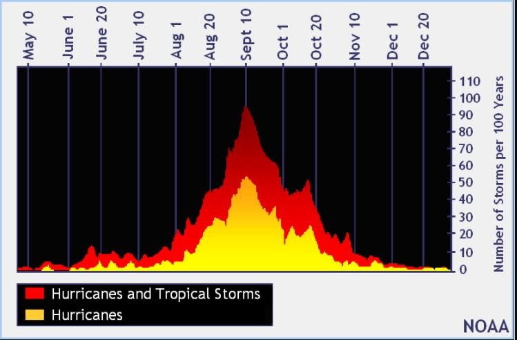
The peak of the season was Sept. 10. Most activity in the Atlantic basin happens between mid-August and mid-October, according to the Hurricane Center.
What are names for 2026 Atlantic hurricane season?
Here are the names for the 2026 Atlantic hurricane season and how to pronounce them:
Arthur: Tropical Storm Arthur formed June 17, 2026
Bertha: Tropical Storm Bertha formed July 20, 2026
Cristobal: Tropical Storm Cristobal formed Aug. 12
Dolly: Tropical Storm Dolly formed Aug. 27
Edouard: Tropical Storm Edouard formed Sept. 1
Fay, fay: (sixth-named storm historically forms Aug. 29; first hurricane by Aug. 11; and first major hurricane Sept. 1)
Gonzalo, gohn-SAH-loh
Hanna, HAN-uh
Isaias, ees-ah-EE-ahs
Josephine, JOH-seh-feen
Kyle, KY-ull
Leah, LEE-ah
Marco, MAR-koe
Nana, NA-na
Omar, OH-mar
Paulette, pawl-LET
Rene, re-NAY
Sally, SAL-ee
Teddy, TEHD-ee
Vicky, VIH-kee
Wilfred, WILL-fred
Interactive map: See how many hurricanes, tropical storms have passed near your homeStay informed. Get weather alerts via textWhat's next?
We will continue to update our tropical weather coverage to bring you the most current information you need to protect your home and family.
This story has been to include new information.
Cheryl McCloud is a journalist for the USA TODAY Network-Florida's service journalism Connect team. You can get all of Florida’s best content directly in your inbox each weekday day by signing up for the free newsletter, Florida TODAY, at https://naplesnews.com/newsletters.
This article originally appeared on Naples Daily News: Hurricane Center ups chances for tropical depression. Where it's going
Our editors independently choose our recommendations. Some content is produced with paid support from a third party, however our editorial decisions remain independent. If you buy through our links, the USA TODAY Network may earn a commission. Prices and availability may change.
Source: “AOL Breaking”
